
Manchester What's On, Entertainment, Tickets and Eating Out Guide
Wednesday 13 May 2026
[@]The City of Salford
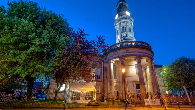
Explore the history of Manchester’s sister city Salford
Published: Guide No.17 - April '22
In the modern era, Salford started as a village on the east banks of the river Irwell settled in and around what today is Chapel St. The small hamlet was clearly described in their 1751 Casson & Berry map of Manchester.
As the Industrial Revolution swept across England, Salford quickly grew in status and it became one of the first major industrial towns.
In its mills cloth and silk was being weaved, while nearer the river dyeing and bleaching was being carried out, as these processes required a lot of water.
During this rapid growth period Salford, like its neighbour Manchester, experienced a huge population influx.
Mostly caused by the demand for workers in the mills and driven by the reduction of manual labour required for farming, because of ‘modern’ machinery.
The Industrial Revolution was a time of major change for Britain. It saw the growth of the middle-classes as entrepreneurs who saw the protentional of opening mills which drove a large demand for workers and supporting industries to keep the mills operating 24/7.
However, the working environments where very dangerous and further compounded by living in the over populated and polluted slums within Salford and Manchester.
Salford was incorporated as a municipal borough in 1844 and at this time Friedrich Engels, one the grandfathers of Marxism, was living and working in Manchester.
A philosopher and writer his book, ‘The Condition of the Working Class in England’ and in the section of ‘The Great Towns’ he had this to say about Salford:
“If we cross the Irwell to Salford, we find, on a peninsula formed by the river, a town of 80,000 inhabitant. ...Salford, once more important than Manchester, was then the leading town of the surrounding district to which it still gives its name, Salford Hundred.
Hence it is that an old and therefore very unwholesome, dirty, and ruinous locality is to be found here, lying opposite the Old Church of Manchester, and in as bad a condition as the Old Town on the other side of the Irwell.”
And Engels continues:
“All Salford is built in courts or narrow lanes, so narrow that they remind me of the narrowest I have ever seen, the little lanes of Genoa. ... These lanes of Chapel Street, Greengate and Gravel Lane have certainly never been cleansed since they were built.”
The Manchester Ship Canal, completed in 1894, introduced a system of docks on the Salford side of the canal and it cemented the city’s dependence on its industrial heritage.
Those docks, now known as Salford Quays, where a major hub helping to move the goods shipped there on the Bridgewater, Rochdale and Ashton canals.
Loading the produce onto larger ships that can easily navigate the Manchester Ship Canal to Liverpool and thus the rest of the world.
This in turn drove the fortunes of Salford and it was granted City status by a royal charter in 1926. However, the great depression of 1930s took a hard toll on Salford. It saw its factories becoming uncompetitive, in the new world economy, and by 1939 its population had declined by 29%.
A survey in 1931 concluded that Salford contained some of the worst slums in the country. A statement that would not have surprised Friedrich Engels.
The slums clearances projects where under way by 1933 and today that old community and townscape has been replaced the tower block.
More areas where redeveloped in the 1960s and 1970s including the Victorian era terraced streets that inspired the Painter L.S. Lowry and his tutor the French impressionist Pierre Vallette [Visit The Lowry exhibition at the Lowry Theatre, The Quays. See Valette’s work at the Manchester Art Gallery, Mosley St].
The last nails in the coffin came in the mid 1970s when containerisation became the efficient way to ship goods. Liverpool and thus the Salford docks where too small to handle these vast ships and the shipments.
The 20th Century and Regeneration
The Salford docks where finally closed in 1982, demolished and by 1984 the area was derelict.
Salford City Council purchased the entirety of the docks in 1984, for the princely sum of £1m and with amazing speed the Salford Quays Redevelopment Plan was adopted leading to the modern and vibrant district it is today.
One of the very first openings was the Lowry Theatre, named after the famous Salfordian painter. This huge multi-use space is home to three theatres and two large exhibition spaces.
Soon after the Lowry Shopping Mall opened its’ doors and the Imperial War Museum North was built and it is a highly respected tourist attraction.
Whilst in Trafford, the Old Trafford Cricket and Football grounds also draws in visitors to the Quays.
Another huge success for Salford was the building of the national media hub called MediaCityUK. Opened in 2011 it saw the BBC and ITV broadcasters working together to create new studios, sets and working spaces that is the heart of the UK’s television network.
This vast development is a work in progress with new facilities and studios being built it has helped to return the Quays to a hive of activity.
Residential opportunities have opened up too. There are new projects are being built across the City seeing the redevelopment of sites like Chapel Street, Greengate Square, The Crescent and major work in Pendleton.
The future is looking strong again for this once small village and subsequently important Industrial town.
Salford Regeneration 21st Century
Salford has history of trying to reinvent itself.
Whether this be the change from small village to an industrial city or trying to come to terms with the 1930s great depression and the subsequent slum clearances.
The closure of the Ship Canal Docks, 40 years ago, was the point where Salford decided to take on the 21st Century, with re-purposing of the huge dockland.
Now 20 years later Salford has returned to its vision to build a city that will be fit-for-purpose drive business and create desirable residences. This challenging plan is called ‘The Crescent’.
The idea is to transform the east of the borough bordering Manchester, at the river Irwell, into modern and busy metropolis. Centred around Peel Park and the University of Salford it will see major redevelopment of A6 corridor, extending though The Crescent and out past the University grounds, an area of no less than 240 acres.
Plans for new pedestrian sky walkways, a big extension of the Metrolink tram network and changes to road networks, to remove general traffic, are all included in this £2.5Billion investment (somewhat bigger than the £1m purchase of the Salford Docks in 1984), which should be complete by 2040.
It sets out targets to create 3000 new homes and in excess of 1 million square feet of modern office, retail and leisure space. All set within a new green environment.
Part of the plan is for an ambitious 11-meter wide podium spanning Frederick Street.
This sky walkway has been designed improve the movement around the Innovation Zone with the aim of creating a ’15-minute neighbourhood’ (whatever that actually means?).
The Parks and Rivers zone covers public open spaces bordered by the river Irwell, David Lewis Playing Fields, Peel Park and the Meadows. It includes provision for the creation of cycleways, new paths and a return to native tree species.
The Crescent will also be transformed under the plan. The repurposing of the Old Police Station as a Hotel while the Fire Station becomes a new community and start-up business hub.
Most notably for locals the, somewhat derelict, University buildings of Humphrey House, Crescent House and Faraday Building will be demolished to make way for new residential housing. This will be matched by the redevelopment of the Adelphi Village east of the river.
This combined with the future development of the east of Manchester City, well under way, will make the two cities boundaries almost seamless. A bright future for All.
Read Our Guides
Unlock Manchester visitor guides are available in hotels and magazine racks across the city. You can also read them for FREE online at issuu.com

What's On in Manchester?
Cinema, Theatre, Music and Events: find out what’s on in Manchester today, this week and coming soon with our FREE listings
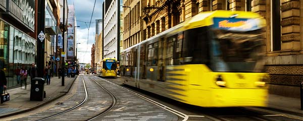
Manchester Transport Services
Buses, Trams, Trains and Private Hire Taxis: Manchester has a solution for you to get where you need to be.
Manchester a City of ‘Quarters’

Bury
Only 30 minutes by Tram from the City Centre, Bury and its attractions make a good day trip
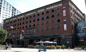
Castlefield
Nestled between the Irwell and Medloack rivers Castlefield is where the Romans established 'Mamucium'. Experience the old and modern and explore its attractions
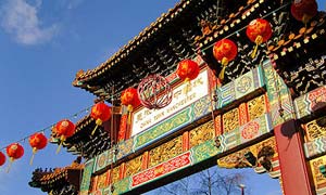
China Town
China Town, a stone's throw from Piccadilly Gardens, offers restaurants, specialist supermarkets and entertainment all in one space
Deansgate
Connecting most parts of the city, this mile-long road is worth a stroll along and offers some great shops and places to eat
Read About All Manchester‘s Quarters
@UNLOCKMCR
Join our Mailing List